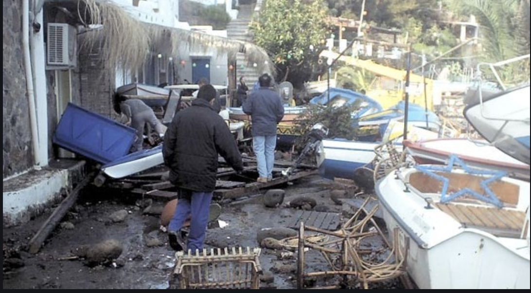
When people picture a tsunami, they picture Southeast Asia in 2004 or Japan in 2011 – the Pacific “Ring of Fire,” not the sun-bleached coastlines of Italy and Greece.
But Europe has its own history of walls of water crashing into fishing villages, tourist islands, and even quiet Norwegian fjords.
Some of these events rank among the deadliest natural disasters the continent has ever recorded.
Here’s a look at Europe’s most destructive tsunamis since the beginning of the 20th century – and why scientists say the risk hasn’t gone away.
1908: One of the Deadliest Earthquakes in European History
Just after 5:20 a.m. on December 28, 1908, a magnitude-7.1 earthquake ruptured beneath the Strait of Messina, the narrow channel separating Sicily from mainland Italy.
The shaking lasted roughly 30 to 40 seconds and leveled an estimated 90% of the buildings in the city of Messina, according to Italy’s Civil Protection Department.
Minutes later, the sea pulled back dramatically – receding as much as 70 meters, by some accounts – before slamming back onshore in a series of waves that reached about 12 meters (39 feet) high.
The combined earthquake and tsunami killed a staggering number of people. Estimates vary widely depending on the source, ranging from roughly 60,000 to more than 120,000 deaths, according to Wikipedia’s compiled seismological data and contemporary accounts – making it, by most measures, the deadliest earthquake ever recorded in Europe.
Entire coastal neighborhoods where survivors had fled the collapsing buildings were wiped out by the incoming waves.
1934: When a Mountain – Not an Earthquake – Triggered a Megatsunami
Not every European tsunami starts with an earthquake. In the early hours of April 7, 1934, roughly 3 million cubic meters of rock broke away from a cliff face 730 meters above Norway’s Tafjorden fjord and crashed into the water below.
The displaced water surged outward in three enormous waves, the tallest of which reached a run-up height of more than 60 meters near the point of impact, according to research from the Norwegian Geotechnical Institute (NGI).
Within minutes, the waves – traveling at speeds researchers have estimated near 160 km/h (100 mph) – slammed into the villages of Tafjord and Fjøra, killing 40 people.
It’s one of several rockslide-triggered “megatsunamis” that have struck Norway’s steep fjords over the past century; a similar event at Loen killed dozens more in 1905 and 1936. Norwegian authorities now keep unstable mountainsides under continuous satellite and radar surveillance for exactly this reason.
1956: The Aegean’s Worst Tsunami in Modern History
On July 9, 1956, a magnitude-7.7 earthquake struck the Aegean Sea near the Greek island of Amorgos – the strongest quake to hit Greece in the 20th century.
It triggered the most powerful tsunami ever recorded in the Aegean, with run-up heights reaching around 25 to 30 meters on Amorgos’s southern coast, according to a study published in Geophysical Journal International.
Waves radiated outward across the Cyclades and Dodecanese island chains, reaching as far as Crete and the Turkish coast, and caused significant damage on the famous island of Santorini.
The combined earthquake and tsunami killed 53 people. Recent research published in Geophysical Research Letters suggests the destruction was driven by an unusually large seafloor rupture, possibly amplified by underwater landslides – a reminder that the fault lines running beneath the Aegean remain capable of producing outsized waves.
2002: A Volcano Sends the Sea Rushing Backward
Stromboli, a small, perpetually erupting volcanic island off Sicily nicknamed the “Lighthouse of the Mediterranean” for its near-constant fireworks display, delivered a very different kind of scare in December 2002.
As lava poured down its flank, two massive landslides – carrying an estimated 16 million cubic meters of rock and debris – tore loose and plunged into the sea within minutes of each other.
The impact generated two tsunamis, with waves reaching roughly 10 to 11 meters at their peak, according to research published in the Bulletin of Volcanology.
The waves battered the island’s coastline and reached the neighboring island of Panarea, injuring several people and causing significant property damage.
Remarkably, no one died – largely because the eruption happened outside peak tourist season, when the island’s population is a fraction of its summer size.
2020: A “Mini-Tsunami” Catches Two Nations Off Guard
On October 30, 2020, a magnitude-7.0 earthquake ruptured in the Aegean Sea between the Greek island of Samos and the Turkish city of Izmir.
The shaking caused catastrophic building collapses in Izmir’s Bayraklı district, and, according to the U.S. Geological Survey and Turkey’s disaster management agency AFAD, killed 117 people in Turkey and two on Samos – one of the deadliest earthquakes to hit the region in decades.
The quake also triggered a fast-moving local tsunami that surged into the streets of Seferihisar, near Izmir, and inundated parts of Samos’s coastline within minutes, according to UNESCO’s Intergovernmental Oceanographic Commission. One person drowned.
Because tsunamis generated so close to shore leave almost no time for a warning to reach people before the water arrives, UNESCO singled out the event as proof that local, “near-field” tsunamis remain one of the hardest hazards to prepare for anywhere in the world – Mediterranean included.
The Risk Hasn’t Disappeared
Taken together, these events reveal something most people outside geology circles rarely think about: the Mediterranean and its surrounding seas sit atop one of the most seismically and volcanically active regions on Earth.
The collision zone between the African and Eurasian tectonic plates runs directly beneath southern Italy, Greece, and the Aegean, while Norway’s glacially carved fjords remain lined with unstable, slowly cracking cliffs.
That’s why a dedicated early-warning system – the North-eastern Atlantic, Mediterranean and connected seas Tsunami Warning System (NEAMTWS), coordinated through UNESCO – now monitors seismic activity across the region around the clock, alongside national agencies in Italy, Greece, Turkey, and Norway.
It’s a quiet acknowledgement that the wave that flattened Messina in 1908, or the one that funneled down a Norwegian fjord in 1934, could, under the right conditions, happen again.
Sources:
- Encyclopaedia Britannica; Italy’s Civil Protection Department (Dipartimento della Protezione Civile);
- U.S. Geological Survey;
- Wikipedia (compiled seismological data);
- Norwegian Geotechnical Institute (NGI);
- Geophysical Journal International;
- Geophysical Research Letters;
- Bulletin of Volcanology;
- UNESCO Intergovernmental Oceanographic Commission;
- Turkey’s Disaster and Emergency Management Authority (AFAD).


