Deep in Ecuador’s Amazon, small farmers are using satellite images, GPS coordinates and digital traceability to prove that their coffee can reach Europe without costing the forest. The experiment offers a glimpse of what the future of global agriculture may look like.
From a distance, it looks like an ordinary coffee farm. Coffee plants grow beneath taller trees. Fruit trees rise among the crops. Forest remains standing around the fields. But somewhere above the canopy, a satellite is watching.
The location of the farm can be mapped. Its boundaries can be recorded. Historical satellite imagery can help establish whether forest was cleared. And the journey of the coffee can be documented from a small plot in the Ecuadorian Amazon to a European buyer thousands of miles away.
This is becoming increasingly important as the European Union, which is the largest single market in the world, prepares to enforce one of the world’s most ambitious attempts to separate global commodity markets from deforestation.
And Ecuador – a country often associated abroad with the Pacific Ocean and the Galápagos Islands – has quietly become one of the more interesting places to watch.
The Rule Changing the Journey From Forest to Supermarket
The European Union’s Deforestation Regulation, known as EUDR, is designed to ensure that certain commodities entering the European market are not linked to deforestation or forest degradation.
The list includes seven major commodities: cattle, cocoa, coffee, oil palm, rubber, soy and wood, together with certain products derived from them. The principle is simple, although putting it into practice is anything but.
Companies placing covered products on the EU market must be able to demonstrate that they were produced legally and did not come from land affected by deforestation after December 31, 2020.
They must also provide information allowing the origin of the product to be traced back to the land where it was produced. That is where geography becomes technology.
For coffee or cocoa, it is no longer enough to say that a shipment came from Ecuador. The supply chain increasingly has to be able to answer a much more precise question: Which piece of land did this particular product come from?
Under the EUDR, geolocation information is central to the due-diligence process. For most agricultural plots above four hectares, this means providing the boundaries of the plot rather than simply a general location. Satellite imagery and digital systems can then be used to assess the risk of deforestation.
The regulation entered into force in 2023. Following later amendments and a postponement, its main obligations will apply to large and medium-sized operators from December 30, 2026, with an additional six-month period for most micro and small operators.
For producers in tropical countries, that deadline has created both a challenge and an opportunity. Ecuador appears to have started preparing unusually early.
The Amazon Farmers Getting Ahead of the Rules
Since 2019, nearly 400 coffee producers in Ecuador’s Amazon have participated in a Deforestation-Free Coffee Initiative designed to combine forest conservation with traceability and market access.
The project is particularly active in the southern Amazonian province of Zamora Chinchipe. The model is deceptively simple.
Farmers continue growing coffee, but instead of clearing more forest to expand their fields, they integrate coffee with existing trees and other crops.
Their farms are mapped. Satellite imagery is used to monitor the landscape. Production is documented and independently verified. Between 2022 and 2025, the initiative exported 172.5 metric tons of deforestation-free coffee.
The project now involves 373 producers managing almost 5,000 hectares, with more than 1,200 hectares of natural forest remaining conserved within the participating area. The economic incentive matters.
Farmers are not simply being asked to sacrifice income for conservation. The model is intended to give them access to premium markets and better prices for coffee that can demonstrate its environmental credentials.
According to the Federation of Coffee Producers’ Associations of Southern Ecuador, around 90 percent of the coffee produced under the initiative goes to Europe, with France, Germany and Italy among the main destinations.
In September 2024, the United Nations Development Programme, the Ecuadorian government and the Lavazza Foundation formally partnered around the country’s deforestation-free coffee model, describing it as a way to protect forests while opening new markets for small producers.
The experiment is important because it turns an abstract European regulation into something tangible. A satellite image becomes part of a farmer’s business.
A forest that remains standing becomes part of the value of a bag of coffee. And a GPS coordinate can become the passport that allows that coffee to enter one of the world’s largest consumer markets.
Cocoa Is Following the Same Path
Coffee is not the only Ecuadorian commodity adapting. The country’s cocoa sector is also working to prepare for EUDR.
In 2026, Ecuador’s National Association of Cocoa Exporters said the sector had reached more than 90 percent progress toward compliance, citing improvements in traceability and the georeferencing of farms.
That does not mean that every cocoa farm in Ecuador is already fully compliant, nor that the country as a whole has somehow been certified by the European Union. It means something more interesting.
A major producing country is building the infrastructure needed to make its agricultural exports traceable at the level of individual farms.
In the Amazon, this work is especially significant because many producers are smallholders and Indigenous communities.
Organizations such as Kallari, a Kichwa association based in Napo, have long combined agricultural production with the preservation of traditional forest-based systems.
Kallari was founded to improve the livelihoods of hundreds of Kichwa producers from Amazonian communities, while its products include cacao and coffee.
Another Indigenous producer organization, Wiñak, works with Kichwa smallholders in Napo and has developed cacao production around the traditional chakra agricultural system.
These systems are significant because the Amazon is not simply an empty wilderness surrounding farms. For many communities, the forest is part of the agricultural system itself.
The Country Most People Imagine Differently
Ask someone to picture Ecuador and there is a good chance they will imagine the Galápagos, perhaps the Andes, maybe Quito, volcanoes and the Pacific coast.
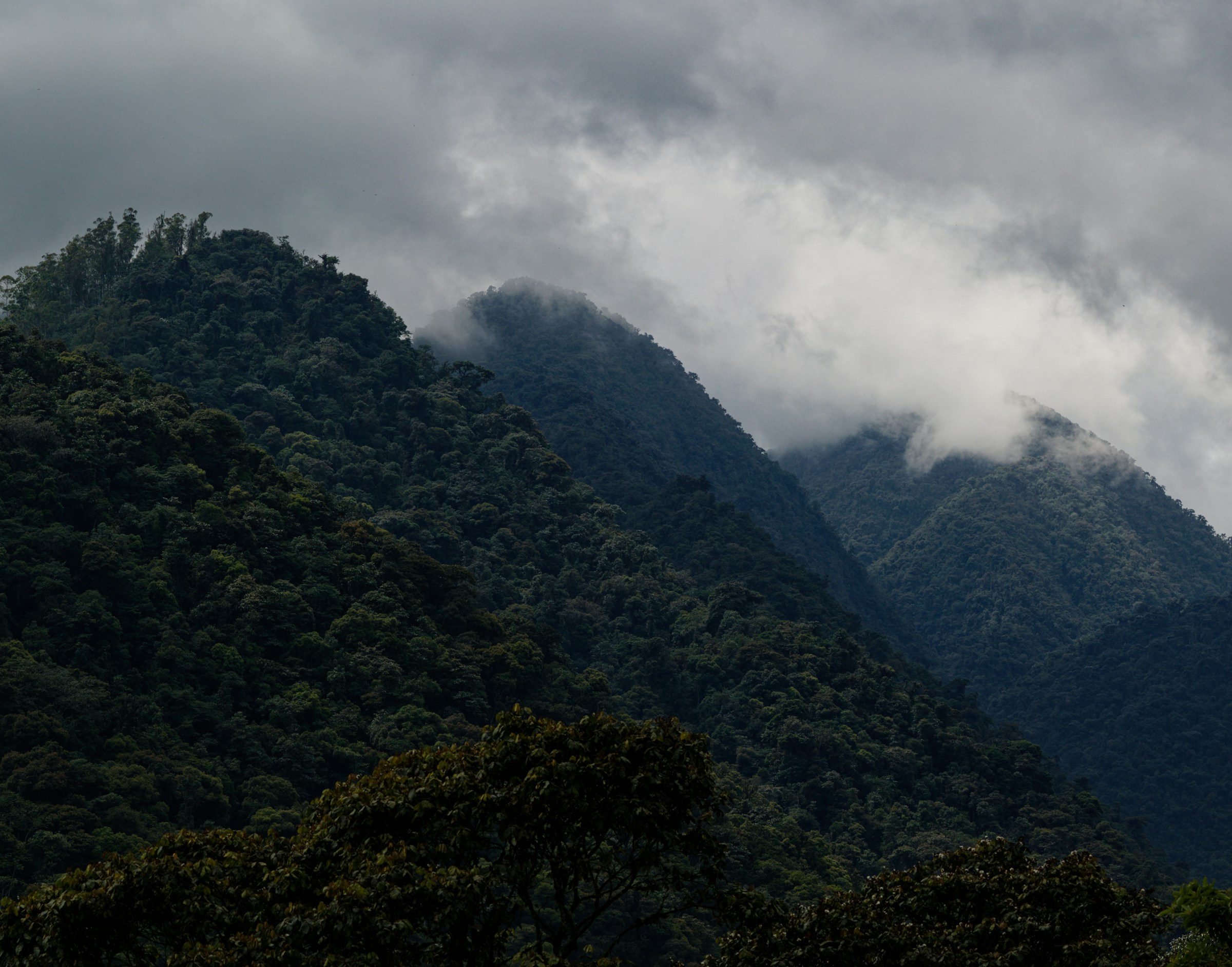
But Ecuador stretches much farther east than that. Beyond the Andes lies a huge portion of the Amazon basin.
According to MapBiomas Ecuador, the country’s Amazonian biome covers roughly 32 percent of the country, or more than 81,000 square kilometers.
By comparison, the country’s humid tropical Pacific forest biome covers about 9 percent. About three-quarters of Ecuador’s native forest is located in the Amazon region.
In other words, the Amazon is not a small corner of Ecuador. It is one of the defining landscapes of the country.
And Ecuador is unusually forested for a nation of its size. World Bank data put forest area at about 49.5 percent of the country’s land area in 2023.
The country’s environmental institute describes Ecuador as one of the world’s 20 megadiverse countries, with 91 ecosystems, including 65 forest ecosystems.
It also notes that Ecuador has an extraordinary concentration of plant species relative to its size. That biological richness changes the meaning of a forest.
In Ecuador, protecting one hectare is not simply about preserving trees. It can mean protecting hundreds of species living within a single patch of rainforest.
A Forest Where One Hectare Can Contain Hundreds of Trees
The Ecuadorian Amazon is part of one of the most biologically complex ecosystems on Earth. In lowland Ecuadorian rainforest, more than 300 tree species can occur within a single hectare, according to a biodiversity overview of the region.
Orchids, bromeliads, ferns and other plants grow throughout the forest, from the floor to the canopy. Across the Amazon basin as a whole, the numbers become almost difficult to comprehend.
The Amazon contains tens of thousands of plant species, thousands of freshwater fish species and an extraordinary range of birds, mammals, reptiles and amphibians.
WWF estimates that almost 50,000 plant species occur across the Amazon. Ecuador contributes a remarkably small geographical slice of this enormous ecosystem, but its forests are exceptionally rich.
The country’s Amazon region is home to places such as Yasuní National Park, one of the most biologically diverse protected areas on Earth, and the Cuyabeno reserve, with its flooded forests, lagoons and wildlife.
The Ecuadorian government tourism authority describes Yasuní as one of the planet’s most biodiverse natural refuges, while Cuyabeno protects a landscape of tropical forest and wetlands. This is the ecological backdrop against which the coffee experiment is taking place.
The Forest Is Worth More Standing Than Cleared
For decades, the economic logic of tropical agriculture was often brutally straightforward. More land meant more production. And more production could mean clearing more forest.
Agricultural expansion remains the largest direct driver of global deforestation, accounting for the vast majority of tropical forest loss associated with land-use change.
That is one of the reasons the EU chose commodities such as coffee, cocoa, cattle, soy, palm oil, rubber and wood for its new regulation. The Ecuadorian experiment proposes a different calculation.
What if the forest itself becomes part of the product’s value? What if a coffee farmer can earn more because the trees around the coffee are still standing? What if European consumers can scan or access information showing where the coffee was grown?
And what if satellites can verify that the landscape has not been cleared to produce it? This does not solve every problem.
EUDR also raises concerns about administrative costs, access to technology and the possibility that small farmers in remote regions could struggle to meet complex documentation requirements.
The burden of collecting geolocation data may be particularly difficult for communities far from roads, internet connections and government services.
That is why Ecuador’s experience is worth watching. Its significance is not that one country has somehow solved deforestation.
It is that a group of small farmers is testing whether technology, traditional agriculture and access to premium markets can make forest conservation economically viable.
A Glimpse of the Future of Food
The story unfolding in Ecuador may eventually extend far beyond coffee. Imagine a future in which a chocolate bar in Berlin, a cup of coffee in Paris or a wooden table in Amsterdam carries an invisible geographic history.
Not simply the country of origin. Not simply the exporter. But the precise landscape where the raw material began its journey. That is the fundamental shift behind the EUDR.
It turns forests into something that global supply chains can no longer treat as an invisible externality. And Ecuador offers an unusually vivid illustration of what that future might look like.
A farmer stands among coffee plants growing beneath native trees. A satellite passes overhead. Somewhere in Europe, a company preparing to buy the coffee needs to know where it came from.
The answer is no longer simply Ecuador. It can be a map. A set of coordinates. A forest that is still there. And, increasingly, that may be what makes the coffee valuable.
Sources:
- European Commission – EU Deforestation Regulation: scope, commodities, requirements and current application dates. (Environment)
- Council of the European Union: explanation of geolocation, satellite monitoring and the purpose of the regulation. (Consilium)
- Mongabay, July 2026: detailed reporting on Ecuador’s Deforestation-Free Coffee Initiative, participating farmers, forest area and European exports. (Conservation news)
- UNDP: Ecuador’s deforestation-free coffee partnership with the government and Lavazza Foundation. (UNDP)
- FAO: impact of EUDR on Ecuadorian cocoa producers, including Kallari, Tsatsayaku and Wiñak. (FAOHome)
- Ecuador’s Ministry of Environment / INABIO: national forest and biodiversity information. (Inabio)
- MapBiomas Ecuador: geographic distribution of Ecuador’s Amazonian and other biomes. (MapBiomas Ecuador)
- World Bank: Ecuador forest-cover data. (World Bank Open Data)
- WWF: biodiversity of the Amazon basin. (World Wildlife Fund)
- Ecuador Tourism: Yasuní and Cuyabeno and the biodiversity of Ecuadorian Amazonia. (Ecuador Travel)