The original Bermuda Triangle, that stretch of the western Atlantic blamed for decades of vanished ships and planes, has never held up well under scrutiny – most of its “mysteries” turn out to have mundane explanations once anyone actually checks the shipping records.
But roughly 6,000 miles away, in the waters south of Madagascar between the southern tip of Africa, Réunion, and Mauritius, there’s a very different stretch of ocean that’s earned a similar nickname for reasons that are considerably harder to wave away.
Journalists and the public have taken to calling it the “Bermuda Triangle of the Indian Ocean” – not an official geographic designation, but a label that’s stuck because of a genuine pattern: more than a century of ships disappearing, breaking apart, or being nearly destroyed in a zone that happens to overlap with some of the most violent, unpredictable ocean conditions on the planet.
The Ship That Vanished Without a Trace
Long before anyone coined the nickname, one disappearance had already given this stretch of ocean its grim reputation.
In July 1909, the Blue Anchor Line steamship SS Waratah, carrying 211 passengers and crew, vanished somewhere between Durban and Cape Town on only her second voyage.
She was considered one of the most advanced and “practically unsinkable” ships of her era – a near-contemporary of the Titanic, three years before that ship’s own fate made the word ironic.
The Waratah was last sighted by another vessel, the Clan MacIntyre, off Port St. Johns on the morning of July 27; by the next day, she was simply gone.
No wreckage, no lifeboats, no bodies were ever recovered, despite multiple search expeditions at the time and, later, decades of private efforts – including a well-funded search led by novelist and underwater-exploration enthusiast Clive Cussler – to find her wreck.
More than 115 years on, she remains one of history’s great unsolved maritime mysteries, and researchers studying the region today point to her disappearance as the first well-documented casualty of exactly the phenomenon that still haunts these waters: the rogue wave.
The Ships That Didn’t Just Disappear – They Were Caught on Film
Unlike the Waratah, several later encounters in these waters were witnessed, documented, and in a few extraordinary cases, even photographed – turning local folklore into hard oceanographic evidence.
On June 13, 1968, the tanker World Glory was carrying 49,000 tons of crude oil roughly 65 miles northeast of Durban when, according to survivor accounts collected by maritime researchers, it was struck by two enormous waves in rapid succession.
The first wave hogged the hull, cracking the main deck; the second produced the opposite sagging force, snapping the 736-foot tanker cleanly in two. Both halves sank within hours, taking all but 10 of the 34 crew members down with them.
Researchers tracking what one NOAA-affiliated study calls “freaque wave” encounters have documented a remarkable cluster of similar incidents along this same stretch of coastline in the years that followed: the tanker Neptune Sapphire broke apart on her maiden voyage in 1973; the liner Bencruachan was struck so violently in 1973 that her passengers had to be winched off by South African Air Force helicopter while a tug towed the crippled vessel backward into Durban at a crawling three knots; and the tanker Wilstar sustained severe bow damage in a 1974 encounter captains in the area still describe as a wave that “came out of nowhere.”
One maritime historian notes that between 1964 and 1973 alone, at least six ships reported serious encounters with these abnormal waves along the same corridor where the Waratah disappeared decades earlier – a frequency that turned what had looked like a single unexplained tragedy into a recognizable, repeating pattern.
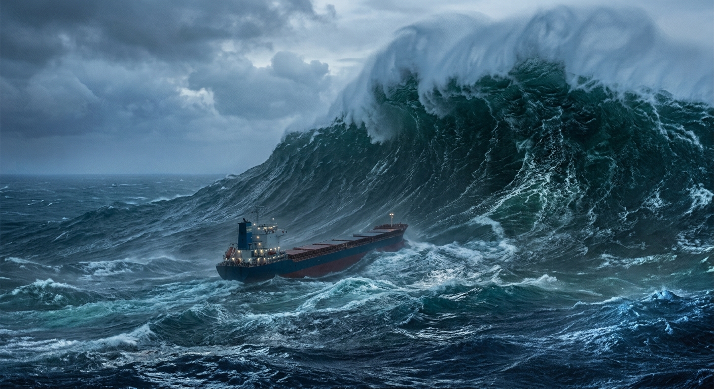
The most famous encounter of all happened in 1980, and it changed ocean science permanently. Aboard the French supertanker Esso Languedoc, off Durban, first mate Philippe Lijour happened to have a camera ready as a wall of water estimated at nearly 100 feet rose in front of the ship’s bow – tall enough to swamp a mast standing 82 feet above the waterline.
The resulting photograph became one of the first pieces of visual proof that rogue waves were real, physical events rather than exaggerated sailor’s folklore, at a time when many oceanographers still treated them as statistically near-impossible.
The Physics Behind the Mystery
Unlike its Atlantic namesake, which largely owes its reputation to storytelling and selective memory, the southern Indian Ocean’s danger is measurable, well-documented, and increasingly well-understood by oceanographers.
The core culprit is the Agulhas Current, one of the fastest and most powerful ocean currents on Earth, which carries warm water south-southwest along South Africa’s eastern coast at speeds up to roughly 2.5 meters per second.
That current runs directly against storm systems rolling up from the Southern Ocean and Antarctica, and the collision between a fast current and opposing swell is a textbook recipe for danger.
When storm-driven waves moving north meet the Agulhas Current moving south, the waves are compressed: their wavelength shortens while their energy, with nowhere else to go, concentrates into dramatically increased height and steepness.
Researchers studying the phenomenon describe a kind of “funnel effect,” in which the current’s edges and the sharp underwater topography of the continental shelf further focus wave energy into a single towering, asymmetrical wall of water – a true rogue wave, scientifically defined as any wave more than twice the height of the surrounding sea state.
Along the stretch of coast between Durban and Cape Town – precisely where the Waratah vanished – these waves have been documented at heights exceeding 30 meters, roughly the height of a 10-story building.
According to Wikipedia’s compiled maritime records, approximately 30 large ships were severely damaged or sunk by rogue waves along South Africa’s east coast in just the single decade between 1981 and 1991, and historians estimate as many as 150 vessels have been lost to the waters around nearby Cape Agulhas over the past several centuries.
What makes these waves so catastrophic isn’t just their height. A rogue wave is typically preceded by an unusually deep trough – sailors sometimes describe it as “a hole in the sea” – which causes a ship’s bow to plunge downward at a steep angle just before the wave itself arrives.
The wave then strikes the ship’s foredeck or superstructure directly, while the vessel’s hull remains unsupported across its middle and ends, creating catastrophic bending stress that can snap even a large steel-hulled ship in half within seconds.
A standard storm wave might exert pressure of roughly 15 to 20 tons per square meter; a genuine rogue wave can deliver more than 100 tons per square meter of impact force, instantly shattering windows, buckling steel decks, and flooding engine rooms.
For decades, this entire explanation remained, in scientific terms, mostly anecdotal – compelling testimony from terrified sailors, but not the kind of hard data peer review demands.
That changed in 1995, when an offshore platform in the North Sea recorded the so-called Draupner wave: the first rogue wave ever measured directly by scientific instruments rather than estimated from damage and eyewitness accounts afterward.
It confirmed that waves roughly twice the height of their surroundings weren’t folklore, and it kicked off a wave of serious oceanographic research – including a 2001 European Space Agency project that used satellite radar to scan the world’s oceans and identified more than ten previously undetected giant waves over just a three-week monitoring period, with the waters off South Africa’s east coast standing out as one of the planet’s most active rogue-wave zones.
Why the Region Swallows Evidence as Easily as Ships
Rogue waves explain how vessels get destroyed. The surrounding geography explains why so little of them is ever found.
This stretch of the Indian Ocean plunges to extraordinary depths – in places exceeding 5,000 to 6,000 meters – and is crossed by powerful subsurface currents capable of carrying wreckage hundreds of miles from the point of sinking before it ever settles.
Debris and remains can scatter across an enormous area, sink into silt on the seafloor, or simply end up too deep for recovery technology to reach economically, which is precisely the combination of factors that has frustrated searchers from the original Waratah inquiry in 1910 through more recent, better-funded expeditions over a century later.
Modern sonar sweeps of the suspected wreck sites along this stretch of coast have turned up old shipwrecks, debris fields, and seabed anomalies – but, so far, nothing conclusively identified as the Waratah herself.
A Region That’s Gotten Safer, Not More Mysterious
None of this requires anything paranormal to explain – oceanographers studying the Agulhas Current describe the physics in increasingly precise detail, and the waters themselves haven’t become more dangerous over time.
What’s changed is the technology available to navigate them. Satellite monitoring of the Agulhas Current, improved storm forecasting, and modern routing software now allow ship captains to identify and avoid the most hazardous sections of the current during major swell events, a capability that simply didn’t exist in the Waratah’s era or, for that matter, through most of the 20th century.
Modern commercial shipping routes are increasingly planned around known rogue-wave hotspots rather than through them, and maritime insurers and weather services actively track conditions in real time.
The result is a genuine decline in incidents compared with the unprotected shipping of a century ago – even as the same underlying ocean dynamics, the same current, the same storms rolling up from Antarctica, continue exactly as they always have.
The “triangle” was never supernatural. It was always just an unusually violent intersection of current, storm, and depth – one that modern instruments have made considerably easier to see coming, even if they can’t make it any less powerful.
Sources:
- Wikipedia’s compiled entries on the Agulhas Current, Cape Agulhas, SS Waratah, and the Draupner wave;
- NOAA’s Great Lakes Environmental Research Laboratory published chronology of historical “freaque” wave encounters;
- Peer-reviewed oceanographic research on Agulhas Current rogue wave formation, including studies published via MDPI’s Journal of Marine Science and Engineering and ResearchGate;
- The European Space Agency’s 2001 MaxWave satellite rogue-wave monitoring project;
- Surfer magazine’s reporting on the 1980 Esso Languedoc photograph;
- Contemporary and historical reporting on the SS Waratah disappearance and inquiry via the British Newspaper Archive and Trove (National Library of Australia).