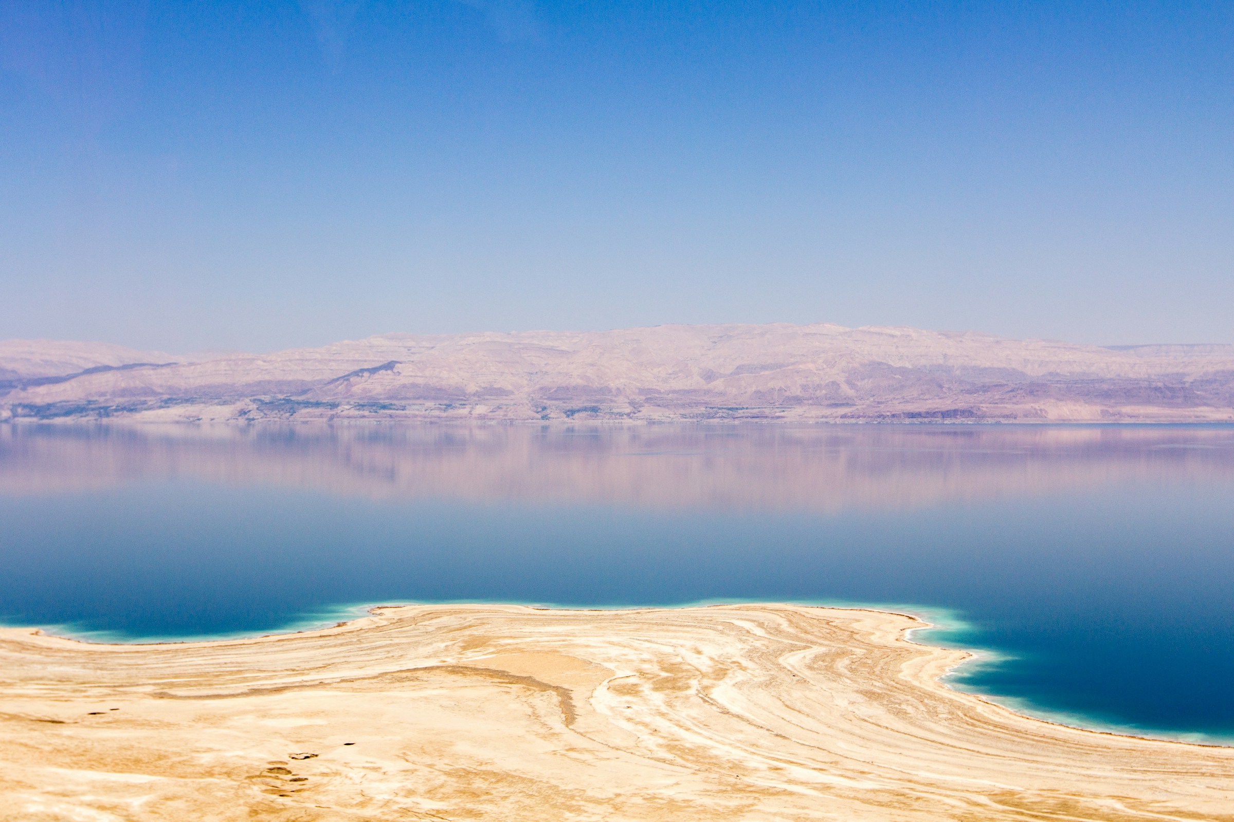
The Netherlands has spent centuries holding back the sea. But some of the world’s most extraordinary low-lying settlements owe their existence not to coastal engineering, but to ancient lakes, desert basins and a geological landscape that sinks far below the ocean.
The Netherlands has made an art form of living with water. Across the country, dikes, dunes, pumps and storm-surge barriers protect homes, farms and entire cities from flooding.
Some Dutch communities stand on land reclaimed from the sea, while vast polders occupy areas that were once lakes or wetlands.
It is an extraordinary feat of engineering – and a reminder that the line between land and water is not always as permanent as it appears on a map.
Yet the Netherlands is not home to the world’s deepest inhabited places below sea level. The lowest settlements on Earth are found in landscapes shaped by a very different force: geology.
In the Jordan Rift Valley, the ground descends toward the Dead Sea, the lowest exposed land surface on the planet. In western China, an enormous desert basin dips beneath sea level.
In California, communities occupy a desert depression created by geological processes and transformed by human water projects.
And beside the Caspian Sea, cities sit below the ocean’s global reference level because the Caspian itself is an enclosed body of water with no natural outlet to the world’s oceans.
These places are not simply low-lying versions of Amsterdam or Rotterdam. Their stories reveal how tectonic forces, evaporation, ancient lakes and changing coastlines can create inhabited landscapes hundreds of metres below sea level.
The following ten settlements illustrate these remarkable extremes. They are not a definitive global ranking: exact elevations vary within urban boundaries, and a settlement’s height is not necessarily the same as the lowest point of the surrounding basin.
1. Neve Zohar, Israel – approximately 370-380 metres below sea level
At the southern end of the Dead Sea, the small Israeli settlement of Neve Zohar occupies one of the lowest inhabited locations on Earth.
The reason is geological. The Dead Sea lies within the Dead Sea Transform, a major tectonic boundary where the African and Arabian plates move past one another.
Over millions of years, movements along this system helped create a deep rift valley. The region’s arid climate compounds the effect: water entering the Dead Sea evaporates rapidly, while the lake has no outlet to the ocean.
The result is an extraordinary landscape of salt-encrusted shores, mineral-rich mud and mountains rising dramatically above the water.
Neve Zohar lies close to this geological low point, although its precise elevation depends on the location measured and the reference data used.
It is a small settlement rather than a major city – an important distinction when discussing the world’s lowest inhabited places.
2. Neot HaKikar, Israel – approximately 345–350 metres below sea level
South of the Dead Sea, Neot HaKikar sits in the Arava Valley, where desert agriculture thrives in a landscape that seems almost impossible for farming.
Established in the 20th century, the community lies in a low basin surrounded by arid terrain. Its elevation is roughly 345 metres below sea level, placing it among the lowest settlements in the world.
The valley’s low altitude does not mean it is underwater. The Dead Sea basin is an enclosed depression, separated from the Mediterranean and other oceans by higher land. There is no open marine channel through which seawater can simply flow in.
Instead, the area’s rivers and seasonal streams drain toward the Dead Sea, while evaporation removes water from the basin.
Modern irrigation allows agriculture to exist in this exceptionally dry environment, but the region remains shaped by water scarcity and extreme heat.
3. Jericho, West Bank – approximately 250-260 metres below sea level
Jericho is one of the world’s most historically significant settlements – and one of its lowest cities. Located in the Jordan Valley, near the northern reaches of the Dead Sea, Jericho stands roughly 250 metres below sea level.
Archaeological evidence from the wider Jericho area reveals thousands of years of settlement, making it one of the most important places for understanding the development of early communities.
Its location helps explain its long history. Springs, fertile land and access to routes linking the Jordan Valley with the surrounding highlands made the area attractive to inhabitants despite the desert climate.
The same geography that helped sustain human life here also created its extraordinary elevation. Jericho lies within the great rift system that stretches from East Africa through the Red Sea and into the Jordan Valley.
It is often described as the world’s lowest city, although claims of this kind depend on how “city” is defined and which urban boundaries are measured.
4. Tiberias, Israel – roughly 200 metres below sea level
Tiberias stands on the western shore of the Sea of Galilee, also known as Lake Kinneret. Its waterfront lies approximately 200 metres below sea level, although the exact figure varies with the lake’s changing level and the elevation of the particular location measured.
The Sea of Galilee is the lowest freshwater lake on Earth. Unlike the Dead Sea, it contains freshwater and forms part of the Jordan River system.
The lake’s elevation is a consequence of the same regional rift geology that created the Dead Sea depression farther south.
The surrounding landscape rises sharply from the water, producing a striking contrast between the lake, the hills and the settlements along its shore.
Tiberias developed as an important regional centre in antiquity and remains a destination for religious tourism, history and recreation.
Its low elevation is not the result of draining a lake or reclaiming land from the sea. It is the result of living beside a lake that occupies a deep geological valley.
5. Beit She’an, Israel – approximately 120 metres below sea level
Farther south in the Jordan Valley, Beit She’an lies around 120 metres below sea level. The city has a long history, and its archaeological remains reveal its importance as a settlement and crossroads in the ancient world.
Its location made sense long before modern roads existed. The valley provided routes between the Mediterranean region and the Jordan River corridor, while nearby water and fertile land supported agriculture.
The elevation is again a product of the regional rift system. The Jordan Valley is not simply a low stretch of ordinary terrain; it is part of a major geological depression extending across several countries.
Beit She’an illustrates how a low-lying landscape can support urban life for thousands of years. Its elevation is unusual, but its history is closely tied to the practical advantages of its location.
6. Turpan, China – parts of the city lie below sea level
In China’s Xinjiang region, Turpan occupies a vast basin surrounded by mountains and desert. The wider Turpan Depression reaches approximately 154 metres below sea level, making it the lowest land depression in China.
The important qualification is that the bottom of the depression is not the elevation of every part of Turpan city.
The urban area spans terrain at different heights, so the basin’s deepest figure should not be presented as the elevation of the entire settlement.
Turpan’s landscape was shaped by tectonic forces that caused the basin to sink relative to the surrounding mountains. Its exceptionally dry climate means that evaporation is high and rainfall scarce.
Yet the region has supported agriculture and trade for centuries. Traditional underground irrigation channels, known as karez, carried groundwater from the foothills toward settlements and fields, helping sustain life in an otherwise harsh environment.
Turpan’s story is a reminder that a location below sea level need not be near an ocean. A dry inland basin can descend below the global sea-level datum while remaining separated from the sea by hundreds of miles of higher ground.
7. Bombay Beach, California, United States – approximately 69 metres below sea level
On the eastern shore of California’s Salton Sea, Bombay Beach occupies a striking desert landscape about 69 metres below sea level.
The community lies within the Salton Sink, a depression in the Colorado Desert shaped by the region’s geology and long history of changing waterways.
The basin has periodically received water from the Colorado River, while evaporation has played a major role in determining whether lakes could persist there.
The modern Salton Sea was created in the early 20th century after Colorado River water breached irrigation works and flowed into the basin.
The resulting lake became a recreational destination, but changes in agricultural drainage, water management and evaporation have contributed to its environmental challenges.
Bombay Beach is now known for its unusual desert setting and art installations as well as its history as a resort community. Its elevation is a product of a natural basin, not a Dutch-style reclamation project.
8. Calipatria, California, United States – approximately 56 metres below sea level
A short distance north of Bombay Beach, Calipatria is another community in California’s Salton Sink.
At roughly 56 metres below sea level, it lies in an agricultural region where irrigation has transformed parts of the desert into productive farmland.
The area’s farming economy depends heavily on managed water supplies, while the surrounding basin remains vulnerable to the environmental consequences of changing water levels and salinity.
The broader depression is part of a geological system connected to the Gulf of California and the lower Colorado River region.
Its low elevation reflects the underlying landscape rather than a former sea being deliberately pumped away.
Calipatria offers a particularly vivid contrast: fields and residential streets occupy land that sits below the ocean’s global level, yet the Pacific is hundreds of miles away and separated from the basin by higher terrain.
9. Baku, Azerbaijan – approximately 28 metres below sea level
Baku, the capital of Azerbaijan, is one of the most striking examples of a major city below sea level.
Situated on the western shore of the Caspian Sea, Baku stands approximately 28 metres below the global sea-level reference. It is often described as the world’s lowest-lying national capital.
The explanation lies in the Caspian itself. Despite its name, the Caspian Sea is an enclosed inland body of water with no natural outlet to the world’s oceans.
Its surface lies below global mean sea level, and the surrounding Caspian Depression includes extensive areas of low-lying land.
Baku’s geography helped shape its history as a port, trading centre and major oil-producing city. Today, its modern skyline rises above a coastline where the relationship between land and water is fundamentally different from that of an open ocean shore.
The Caspian’s water level also fluctuates, creating environmental and infrastructure challenges for the communities that depend on it.
10. Atyrau, Kazakhstan – approximately 20 metres below sea level
At the mouth of the Ural River, Atyrau sits in Kazakhstan’s Caspian Depression, around 20 metres below sea level.
The city occupies a remarkable geographical position near the conventional boundary between Europe and Asia.
The Ural River flows through the city toward the northern Caspian, connecting inland waterways with one of the world’s largest enclosed bodies of water.
Atyrau grew into an important industrial and oil-producing centre. Its location near major energy resources has shaped its modern economy, while the low-lying landscape links it to the wider environmental changes affecting the Caspian basin.
As in Baku, the explanation is not that the ocean has been pushed back by dikes or pumps. The Caspian’s surface is itself below global sea level, and the surrounding land lies within a broad inland depression.
The city’s elevation is therefore part of a much larger geographical story — one involving river systems, an enclosed sea and a basin whose water levels have changed over time.
Sources:
- Government of the Netherlands – Water Management. Official overview of the country’s flood defences, water authorities, dikes and storm-surge barriers. The Dutch government notes that roughly a quarter of the country lies below sea level. (government.nl)
- Rijkswaterstaat – The Delta Works. Background on the Netherlands’ major flood-protection system. (rijkswaterstaat.nl)
- Neot HaKikar and Neve Zohar – elevation data. Geographic references for the two settlements south of the Dead Sea. (en.wikipedia.org and mapcarta.com)
- Sea of Galilee – elevation and geography. Background on the lake’s location in the Jordan Rift Valley and its changing surface elevation. (en.wikipedia.org)
- Turpan Basin – Chinese government geographical overview. Describes the Turpan Depression and its lowest elevation in China. (ly.china-embassy.gov.cn)
- List of places on land below sea level. A useful starting point for comparing the Salton Sink settlements and other low-lying places; individual elevations should be checked against geographic or official local sources. (en.wikipedia.org)
- Azerbaijan Travel – Baku. Tourism authority information noting the capital’s position below sea level. (Azerbaijan Travel)
- Atyrau – geography and elevation. Reference information on the city’s position in the Caspian Depression and its elevation of approximately 20 metres below sea level. (Wikipedia)


