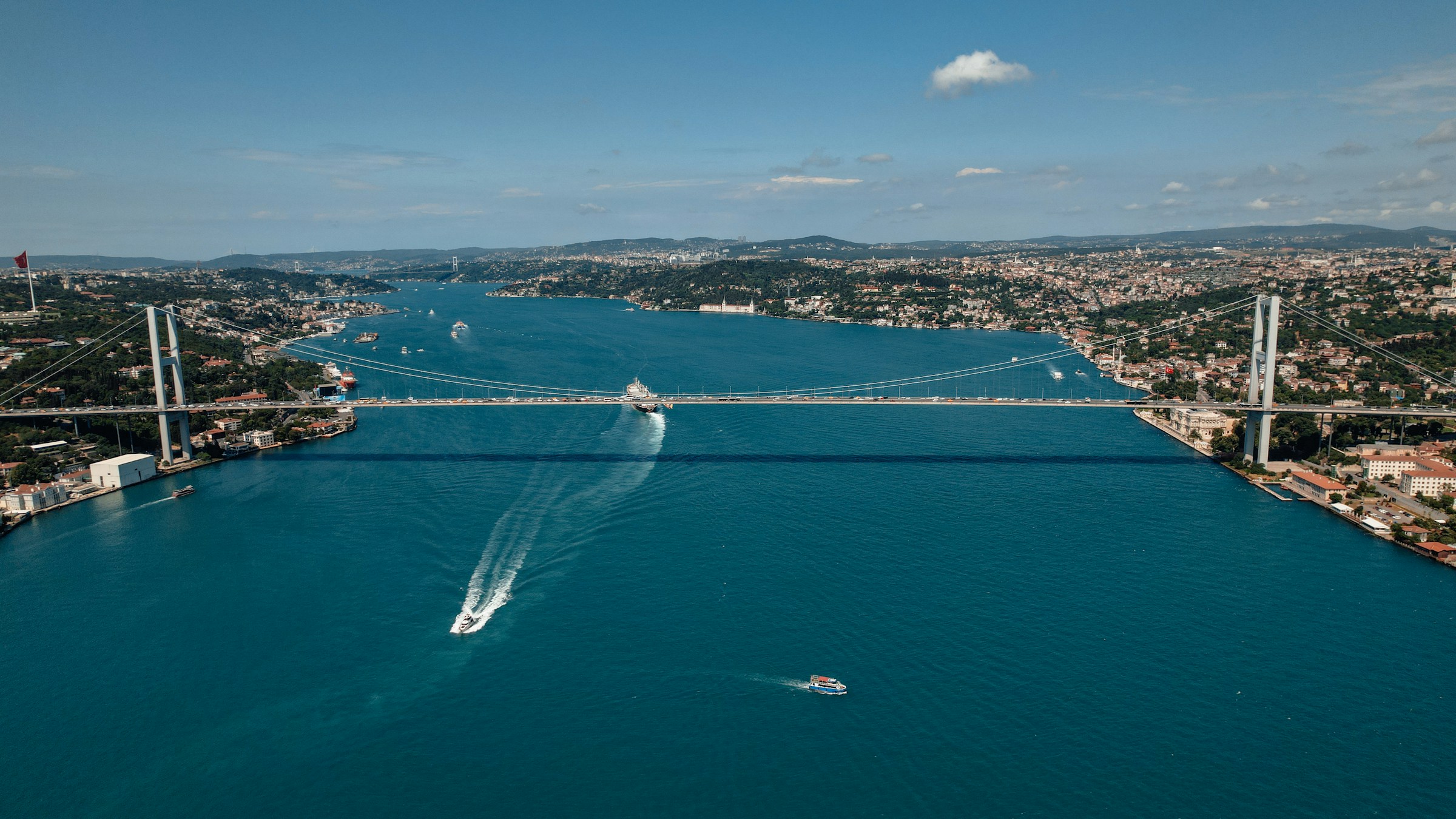
Every year, roughly 41,000 ships squeeze through the Bosphorus, a natural winding channel less than half a mile wide at its narrowest point, cutting straight through a city of more than 15 million people. It is the only way out for an entire sea.
The Black Sea covers more than 436,000 square kilometers and plunges to depths of over 2,200 meters (around 7,200 ft), yet everything that sails to or from its ports must pass through this one narrow gap, then across the Sea of Marmara, then through a second strait, the Dardanelles, before reaching the open Mediterranean.
Turkey’s proposed answer to that bottleneck is to dig a second one. Kanal Istanbul, a planned sea-level waterway running parallel to the Bosphorus, would be roughly 45 kilometers long and large enough for oil tankers. It would turn the European half of Istanbul into an island.
Five years after a ceremonial groundbreaking, not a single cubic meter of the canal itself has been dug, and its future remains one of the most contested questions in Turkish politics.
An Idea Older Than the Republic
The canal is often described as a modern fantasy, but the dream of cutting through the Thracian peninsula is centuries old.
According to the historical record compiled by Turkish researchers, the first proposal dates to the reign of Suleiman the Magnificent in the 16th century, with the great architect Mimar Sinan reportedly drawing up plans.
An imperial decree in 1591 revived the idea, and later sultans returned to it in the 17th and 18th centuries. In total, a canal linking the Black Sea to the Marmara has been proposed at least seven times, and each time the work was halted, often for lack of money.
The modern version came in April 2011, when then-Prime Minister Recep Tayyip Erdoğan unveiled it during an election campaign, and dubbed it his “crazy project” (çılgın proje) – a term he used to emphasize its ambition, which quickly stuck in public discourse. The final route was announced in January 2018.
A ministry-approved environmental impact assessment followed in 2020, and in June 2021, Erdoğan laid the first foundations of a bridge over the future canal, putting the cost at about $15 billion and promising completion within six years.
Where It Would Run
The planned route lies entirely on the European side of Istanbul, west of the Bosphorus. It begins at Lake Küçükçekmece, a lagoon on the shore of the Sea of Marmara, runs north past the Sazlıdere Dam, and reaches the Black Sea in the Arnavutköy district, east of Lake Terkos near the village of Durusu.
Along the way it crosses the districts of Avcılar and Başakşehir, and the largest share of the route, about 28.6 kilometers, runs through Arnavutköy.
| Planned specification | Figure |
| Length | About 45 km (28 miles) |
| Depth | 20.75 m (68 ft) |
| Width | 360 m at the surface, 275 m at the bottom |
| Largest ships | Roughly 275-350 m long, with a draft of 17 m |
| Capacity | Up to about 160 transits a day |
| Excavation | About 1.17 billion cubic meters |
| Official cost estimate | About $15 billion for the canal itself |
Sea Level, Not Panama
One of the first questions engineers ask about any canal is whether ships will have to climb. Panama’s answer is locks: its vessels are lifted roughly 26 meters up to Gatún Lake and lowered again on the other side.
Kanal Istanbul is designed as a sea-level canal with no locks at all, closer in concept to the Suez Canal. Both ends would sit essentially at sea level. That doesn’t mean the land in between is flat. The route crosses the low upland of Thrace.
At its southern end, Lake Küçükçekmece sits at about sea level, and Lake Terkos to the north lies only a few meters above it, but between them the ground rises into ridges that would need deep cuttings.
The official figures published by the government give the excavation volume rather than a single elevation profile, and one project analysis cites cuts of up to about 100 meters below ground level in the highest sections.
Roughly 1.17 billion cubic meters of earth would have to be moved, and the plan is to use part of the spoil to build artificial islands.
The water itself would also move through the canal. The Black Sea sits on average about 35 to 55 centimeters higher than the Marmara, a gap that shifts with river discharge, air pressure and storms and occasionally reverses. That small difference drives the Bosphorus’ famous currents, and it would drive a current through the canal as well.
The Strait Nature Built
To understand what the canal might change, it helps to understand the strait it is meant to relieve.
The Bosphorus is about 31 kilometers long, between 700 meters and 3.7 kilometers wide, and roughly 36 to 110 meters deep, with a shallow sill in its southern half. It is widely described as the world’s narrowest strait used for international navigation.
It is also a two-layer river. Oceanographers have measured a surface current of fresher Black Sea water, with a salinity of around 18 parts per thousand, flowing south toward the Marmara at roughly 600 cubic kilometers per year.
Beneath it, a denser undercurrent of Mediterranean water, with a salinity of about 38, flows north into the Black Sea at roughly 300 cubic kilometers per year. The two streams are separated by a thin boundary and pass each other in the same channel.
The Sea at the End of the Pipe
That undercurrent matters more than it might appear. The Black Sea receives enormous quantities of fresh water from rivers, including the Danube, the Dnieper, the Dniester and the Don, and its only outlet to the world ocean is the Bosphorus.
Because its fresher surface water floats on top of denser salty water, the two barely mix. Below roughly 150 meters, oceanographic reviews describe near-complete oxygen starvation, a permanent anoxic layer that preserves ancient shipwrecks and supports almost no animal life.
This is why researchers treat any change to the Turkish Straits with caution. Simulations of the canal’s hydrodynamics, including a 2020 study in the journal Ocean Dynamics, suggest that unlike the Bosphorus, which flows both ways, the canal would carry water south nearly all the time in a single layer.
Models indicate that this could make the upper 25 meters or so of the Marmara less salty. What it would mean for the Black Sea itself is less settled.
Scientists cited in published assessments say the ecosystems of both seas could be affected, and an independent evaluation commissioned by the Istanbul municipality warned of reduced salinity and an increased nitrogen load in the Marmara.
Government officials dispute these projections, pointing to official environmental studies showing that the canal will not cause severe harm to the surrounding marine ecosystem.
Why Turkey Wants It, and Why Others Don’t
The government’s case rests on safety. About 8,000 tankers a year pass through the Bosphorus carrying some 145 million tons of crude oil, according to figures cited by Turkish officials.
A collision or spill near the city’s densely populated shores could be catastrophic. A second route, officials argue, would take the heaviest traffic out of the heart of Istanbul.
Ministers have also projected as much as $8 billion a year in revenue, a figure that independent Turkish economists and opposition critics question, arguing that transit revenue models may be overoptimistic.
The objections are numerous. The scientific evaluation commissioned by Istanbul’s municipality noted that the first 16 kilometers of the route would pass through soft alluvial soil prone to liquefaction in an earthquake, in a region known for seismic risk, and flagged questions over the disposal of some 53 million cubic meters of sediment that would have to be dredged from Lake Küçükçekmece.
Lake Terkos, which the canal would eliminate, supplies a fifth of Istanbul’s water needs, and the Sazlıdere reservoir lies along the route, so groundwater salinization is a recurring worry.
The government has rejected the claim that the canal would leave Istanbul short of water. Surveys have suggested that most Istanbul residents oppose the project, and the municipal government has fought it in court.
A separate debate concerns the 1936 Montreux Convention, which guarantees free civilian passage through the Turkish Straits in peacetime and restricts the warships of non-Black Sea states.
Turkish officials say the canal, as an artificial waterway, would not fall under Montreux, and Erdoğan has said it has “nothing to do” with the treaty.
Some analysts argue that this would give Ankara new leverage over transit rules and fees, while others note that the Bosphorus would remain open and subject to the convention.
Where It Stands Now
As of October 2026, the canal remains unbuilt. The 2021 groundbreaking involved a bridge over the planned route, not excavation of the waterway.
An Istanbul court annulled the ministry-approved zoning plans in early 2024, though the transport ministry said at the time that work was continuing.
In June 2026, Transport Minister Abdulkadir Uraloğlu said the government had “not abandoned” the project, tying its future to securing financing.
If it does go ahead, the canal would reshape more than shipping lanes. It would split a city, move more than a billion cubic meters of earth, and connect two seas in a place where nature itself did the connecting only recently.
According to sediment studies, the Black Sea reconnected with the Marmara and the Mediterranean roughly 9,500 years ago. Whether Turkey will re-plumb it again remains, for now, an open question.
Sources:
- Official Kanal İstanbul project website (Republic of Türkiye, Directorate of Communications), including the published excavation figures;
- Wikipedia’s compiled entry on the Istanbul Canal, including references to Hürriyet Daily News (route announcement, 2018, and environmental approval, 2020) and Reuters/Euronews (2021 groundbreaking);
- Daily Sabah, Erdoğan’s remarks on the Montreux Convention;
- Turkish Minute (2024 court ruling and ministry response);
- Görür, Orhon and Sözen (eds.), Kanal İstanbul Çok Disiplinli Bilimsel Değerlendirme, Istanbul Metropolitan Municipality (2020);
- Saçu et al., “Hydrodynamics of Canal Istanbul and its impact in the northern Sea of Marmara under extreme conditions,” Ocean Dynamics (2020);
- Peer-reviewed oceanographic studies of Bosphorus exchange flows, including Mediterranean Marine Science (2015);
- Wikipedia’s entries on the Bosporus, the Dardanelles, Lake Durusu, Lake Küçükçekmece and the Black Sea;
- Ecoticias’ June 2026 coverage of the latest ministry statements.


