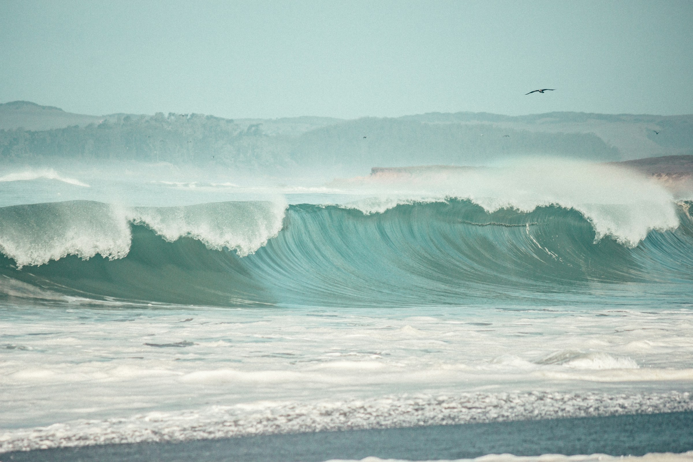
Massive swells are expected to pound the California coast in the coming days. But the approaching waves are only part of a much bigger story: an unusually warm Pacific, a strengthening super El Niño and rising sea levels are combining to put coastal communities under growing pressure.
California is preparing for one of the most powerful ocean swells in recent years, with waves reaching 30 to 40 feet (9 to 12 metres) expected along parts of the northern coastline this weekend.
The approaching swell is being generated by powerful storm systems developing in the North Pacific, where intense winds are pushing enormous amounts of energy across the ocean towards the American West Coast. Some individual waves in the open ocean could exceed 50 feet, according to surf forecasting reports.
The biggest impact is expected in Northern California, particularly along exposed west-facing beaches. The San Francisco Bay Area is also preparing for dangerous surf, with breaking waves potentially reaching 20 to 30 feet at exposed locations. Mavericks, one of the world’s most famous big-wave surfing destinations, could experience even larger conditions.
The National Weather Service has warned of hazardous coastal conditions, including dangerous surf, sneaker waves and powerful rip currents. The combination of large waves and elevated water levels could also increase the risk of coastal flooding and beach erosion.
But this is not simply another spectacular Pacific storm.
California has already experienced significant coastal damage in recent months. Scientists and state officials are increasingly concerned that several unusual ocean and climate conditions are occurring simultaneously, potentially setting the stage for a particularly difficult winter.
What Is Causing the 40-Foot Waves?
The immediate cause is a powerful storm pattern over the North Pacific. Several deep low-pressure systems are developing around the Gulf of Alaska and the Aleutian Islands. As these systems interact with areas of high atmospheric pressure, they create a strong pressure difference that drives powerful winds across large stretches of the ocean.
According to surf forecasting analysis, wind speeds within the storm system could reach 40 to 50 knots, with some stronger gusts. The resulting wind field, known as a fetch, transfers enormous energy into the ocean.
The longer and stronger the wind blows over a large area of water, the more powerful the resulting waves can become.
These waves then travel across the Pacific as long-period swells. Unlike locally generated waves, which are often irregular and relatively short, long-period swells can travel thousands of kilometres while retaining considerable energy.
When they reach the shallower waters near California, they slow down, grow taller and eventually break along the coastline.
This is why a storm hundreds or even thousands of kilometres away can produce dangerous ocean conditions on a distant beach.
The current weather pattern is particularly favourable for generating large waves because successive storms are following a similar track through the North Pacific. Their combined energy is expected to produce several powerful swell events rather than just one isolated episode.
Why California’s Coast Is Particularly Vulnerable This Year
The approaching swell would be a major event under ordinary circumstances. However, California is entering this period with an already elevated level of coastal vulnerability.
Three major factors are contributing to the situation: an exceptionally strong El Niño, a persistent marine heatwave and unusually high sea levels.
1. A potentially historic El Niño
El Niño is a natural climate phenomenon involving unusually warm surface waters across the central and eastern equatorial Pacific. It changes atmospheric circulation and can influence storm tracks across large parts of the world.
The current 2026-2027 El Niño has been strengthening rapidly. In its October assessment, the US National Oceanic and Atmospheric Administration (NOAA) reported that there was more than an 83% chance of a strong-to-very-strong event continuing through January-March 2027.
Some forecasts suggest it could become one of the strongest El Niño events observed since modern records began in the 1950s.
For California, a strong El Niño often increases the likelihood of storms and substantial precipitation during the winter months. It can also contribute to larger waves and temporarily higher coastal sea levels.
This does not mean every storm will be stronger or every beach will experience flooding. El Niño changes the odds and the broader atmospheric pattern; individual storms still determine when and where the most severe conditions occur.
2. An unusually warm Pacific Ocean
California is also dealing with a persistent marine heatwave that began developing in 2025.
A marine heatwave occurs when ocean temperatures remain significantly above their usual levels for an extended period. The phenomenon has affected large areas off the central and southern California coast.
Warmer seawater expands, taking up more space and contributing to higher sea levels. This can make a difference when large waves arrive during high tides or powerful storms.
The California Ocean Protection Council has warned that the marine heatwave and strengthening El Niño are overlapping, creating additional pressure on coastal communities and marine ecosystems.
The combination is especially concerning because the marine heatwave is not simply another consequence of El Niño. It represents an additional ocean warming event occurring at the same time.
3. Higher sea levels are making the impact worse
One of the clearest indications of how unusual conditions have become came in late October.
According to NOAA, several tide gauges along the California coast recorded exceptionally high water levels between October 24 and 30, 2026.
San Diego registered its highest water level on record, while La Jolla, Los Angeles and Santa Barbara also reached their highest recorded levels. Some of these monitoring stations have more than a century of observations.
Several factors contributed to these readings, including unusually high astronomical tides, warm ocean water and El Niño-related ocean processes.
One particularly important phenomenon is the arrival of coastally trapped Kelvin waves. These are large-scale movements of warm water that travel along the Pacific coast of the Americas. They are not breaking waves like those seen at a beach, but they can temporarily raise sea levels by around 6 to 12 inches or more.
When these elevated water levels coincide with high tides, storm surges and powerful swells, the consequences can be severe.
A beach that would normally absorb much of a storm’s energy may offer considerably less protection when the water is already unusually high.
California Has Already Taken a Beating
The latest warnings come after a difficult period for the state’s coastline. In September, hurricane-generated swells reached Southern California, damaging exposed coastal properties and accelerating beach erosion. The waves arrived at a time when sea levels were already elevated, making the impact considerably worse.
Some coastal communities experienced flooding and damage to homes and infrastructure. The events raised concerns among scientists about what could happen if similar conditions return during the winter storm season.
The California coastline is naturally exposed to erosion. Beaches, cliffs and coastal bluffs are constantly reshaped by waves and storms. However, repeated powerful swell events can remove large amounts of sand, undermine cliffs and expose infrastructure that would normally be protected.
The problem is particularly serious in developed areas where homes, roads, railways and public facilities are located close to the water.
The Los Angeles Times has reported on the convergence of these threats, while the California Coastal Commission has urged coastal property owners and communities to prepare for heavy rainfall, large waves, flooding and erosion during the 2026-2027 El Niño season.
What Can We Expect During the Rest of 2026?
The outlook for the remainder of November is not particularly reassuring. Surf forecasting models indicate that the North Pacific storm track could remain active during the second half of the month. Additional significant swells may reach California, including another potentially powerful event before Thanksgiving.
The precise size and timing of individual wave events remain uncertain. Forecasts several days ahead are generally more reliable than predictions made weeks in advance, particularly when storm tracks and wind patterns are still evolving.
Nevertheless, the broader pattern suggests that the current weekend’s swell may not be an isolated event.
The immediate concern is Northern California, but exposed beaches farther south could also experience significant surf as the direction and energy of incoming swells change.
Coastal residents and visitors should follow National Weather Service warnings rather than relying on visual assessments of conditions. Even when the ocean appears relatively calm between sets, individual waves can reach much farther up the beach than expected.
What Does the Winter of 2026-2027 Have in Store?
The bigger question is what happens when the main winter storm season gets underway. NOAA’s October 2026 winter outlook forecasts above-average precipitation across much of California and the southwestern United States between December and February.
This is consistent with the expected influence of a strong El Niño, which can shift the Pacific jet stream southward and increase the likelihood of storm systems reaching California.
The California Coastal Commission has also warned that coastal communities could experience more frequent and intense storms, rainfall and high-wave conditions during the winter.
There is an important distinction, however: seasonal forecasts estimate the likelihood of wetter or warmer conditions. They cannot reliably predict exactly how many major swells will arrive, how high individual waves will become or which beaches will suffer the most damage.
Those details depend on the development and movement of individual storms.
If El Niño continues to strengthen as expected, the risk of repeated coastal impacts could remain elevated into early 2027. NOAA’s outlook indicates that the event is likely to persist through the first months of the year, although its eventual strength and local effects remain subject to change.
For California, the combination of heavy rainfall, saturated ground, elevated sea levels and powerful ocean swells could create a particularly challenging winter.
A Warning Sign for the Future of California’s Coastline
California has always lived with the power of the Pacific Ocean. Powerful winter storms, enormous waves and coastal erosion are not new phenomena. What makes the current situation unusual is the number of factors occurring together.
A strengthening El Niño is influencing the atmospheric circulation. A marine heatwave is keeping ocean temperatures unusually high. Kelvin waves and other ocean processes are contributing to elevated sea levels. Meanwhile, powerful North Pacific storms continue to generate large swells.
None of these factors alone explains all the damage. Together, however, they can create conditions in which even a relatively short period of extreme weather has lasting consequences.
The coming weeks will provide another test for California’s coastline. And with the winter storm season still ahead, the 40-foot waves approaching now may be an early indication of how demanding the months to come could become.
Sources:
- NOAA – Biggest Waves in Years to Slam California Coast – San Francisco Chronicle – wave forecast
- National Weather Service – NWS – San Francisco marine and beach forecast
- Surfline – North Pacific Goes XL to XXL
- NOAA – California Water Levels Break Records – NOAA – Record water levels
- NOAA Climate Prediction Center – ENSO Diagnostic Discussion
- NOAA – U.S. Winter Outlook 2026–2027 – NOAA Winter Outlook
- California Coastal Commission – California Coastal Commission – El Niño preparedness
- UC San Diego / Scripps Institution of Oceanography – 10 Things to Know About This Very Strong El Niño