/Updated Saturday, October 10, 2026. Figures are preliminary and may change./
At 12:56 p.m. on Friday, October 9, the ground beneath Panama’s Azuero Peninsula broke along a fault roughly 12 kilometers below the surface.
The U.S. Geological Survey measured the earthquake at magnitude 7.7, after first reporting a figure as high as 8.0 and revising it downward within hours.
The epicenter lay about 12 kilometers west-southwest of the remote community of Pitaloza Arriba, in Herrera province.
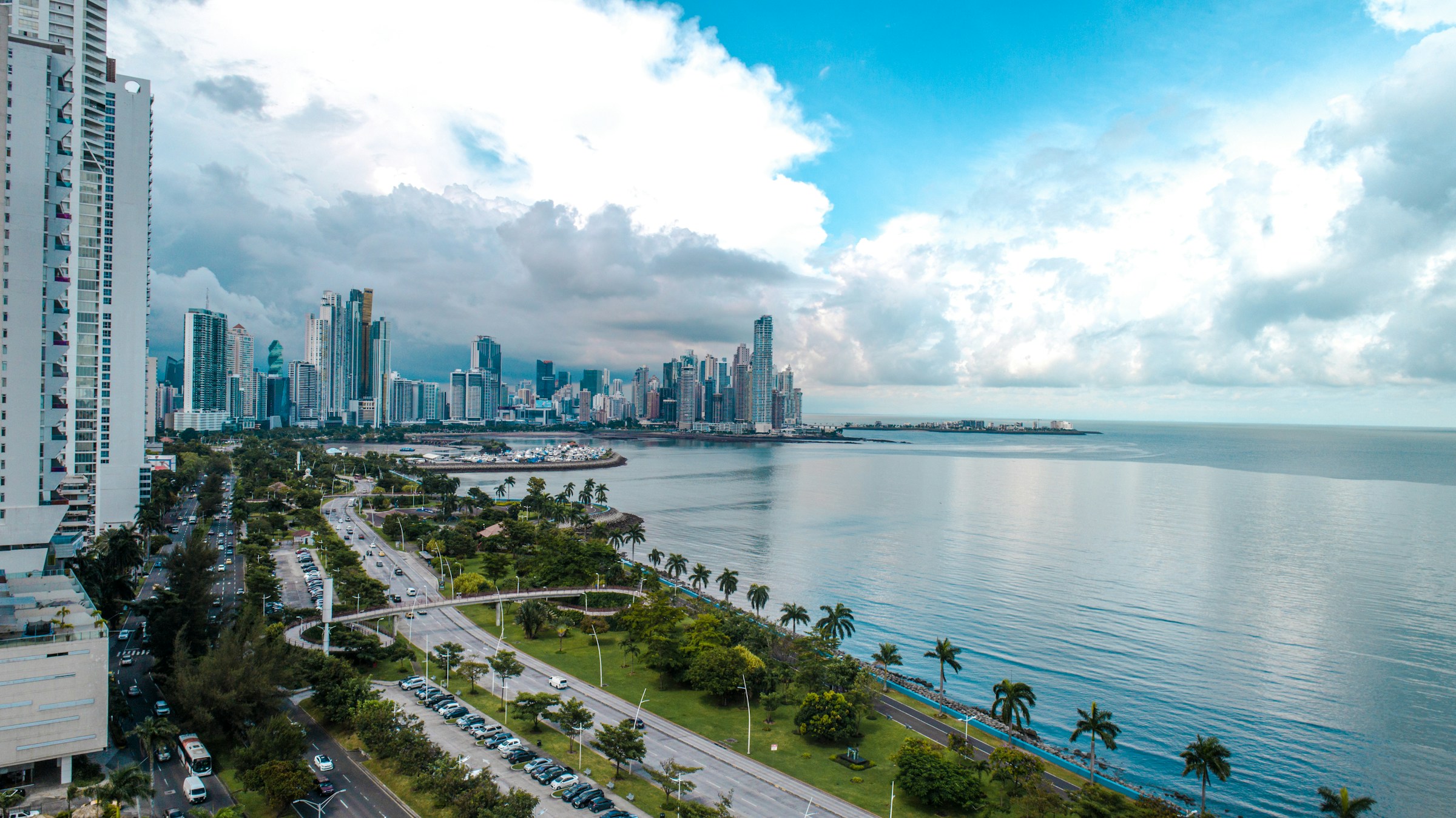
In Panama City, more than 100 miles away, buildings swayed, and the director of the country’s geosciences institute counted about 40 seconds of shaking.
By Saturday, authorities had confirmed no deaths, though at least 27 people were reported injured, and officials cautioned that the numbers could change. For a quake of this magnitude, the early figures are strikingly low.
It also arrives at an unsettling moment: two other powerful earthquakes have struck northern South America this year, one in Venezuela in June and one in Colombia in August, with a combined death toll above 6,800.
What Happened
The damage was concentrated in the central provinces of Veraguas, Herrera, Los Santos and Coclé.
In Penonomé, about 150 kilometers from the capital, the cathedral of San Juan Bautista partially collapsed, the governor’s office and a hotel were damaged, and patients at a local hospital were evacuated and treated outdoors.
Deep fissures split roads in Veraguas. Power supply was disrupted across six provinces, Tocumen International Airport suspended operations for safety checks before reopening, and the Pacific Tsunami Warning Center briefly issued alerts for coastlines from Mexico to Peru before declaring the threat over.
The Panama Canal Authority said ships continued to transit without interruption while engineers inspected facilities under an emergency protocol. More than 140 aftershocks followed, including a magnitude 6.6 event later that afternoon.
The agencies measuring the quake do not fully agree on its size. Panama’s Institute of Geosciences put the magnitude at 7.2 and attributed the rupture to the Azuero-Sona fault system, a network of active faults that its director said had been accumulating stress for some time.
The USGS, whose figure is used by most international agencies, assigned a magnitude of 7.7 and described the rupture as left-lateral strike-slip faulting, in which one block of crust slides sideways past another.
The relatively limited toll probably owes a great deal to geography. According to a USGS exposure estimate reported by Reuters, about 43,000 Panamanians lived in areas that experienced severe shaking or worse.
That compares with nearly 1.4 million people in the zone struck by Venezuela’s twin quakes and more than 1.6 million in western Colombia. One analysis by independent geoscientists calls it the largest on-land earthquake in Panama’s recorded history.
The Third Big Quake in 107 Days
The sequence began on June 24, when two earthquakes of magnitude 7.2 and 7.5 struck northern Venezuela 39 seconds apart, the strongest in the country since 1900, according to Britannica.
Shaking devastated Caracas and the coastal state of La Guaira, and the death toll has exceeded 6,500, with some 17,000 people left homeless.
On August 10, a magnitude 7.4 earthquake hit the Chocó region of western Colombia, killing at least 335 people and injuring more than 4,600, the deadliest in that country since 1999.
| Venezuela | Colombia | Panama | |
| Date | June 24 | August 10 | October 9 |
| Magnitude | 7.2 and 7.5, 39 seconds apart | 7.4 | 7.7 |
| Depth | Shallow, about 10 km | Intermediate, about 96 to 110 km | Shallow, about 10 to 13 km |
| Type | Strike-slip, along the Caribbean–South America boundary | Strike-slip inside the sinking Nazca plate | Left-lateral strike-slip, inside the Panama microplate |
| Reported deaths | More than 6,500 | 335 (official count) | None confirmed; 27 or more injured |
Are the Quakes Connected?
The question is natural, and the answer, from what the physical evidence shows, is that they are not directly linked.
The three ruptures occurred on different faults, at very different depths, and far apart: roughly 600 kilometers separates the Panamanian and Colombian epicenters, and more than 1,000 kilometers separates the Colombian and Venezuelan ones.
The stress that one rupture adds to neighboring rock fades quickly with distance, which is why aftershocks cluster close to the original fault.
Triggering does happen over short distances. Within Venezuela’s June doublet, seismologists believe the first rupture on one fault loaded the second fault nearby and set it off 39 seconds later. Nothing comparable links events hundreds of kilometers apart.
What connects them is the machinery underneath: a crowded set of tectonic plates that all press against one another in the same corner of the planet.
A run of three large earthquakes in a plate-boundary system this active reads like a pattern, though it is better understood as three separate releases of stress along a shared architecture.
A Small Plate in a Vise
To see why, start with the geography. Panama sits on a small fragment of crust that geologists call the Panama microplate, squeezed among four larger plates.
According to the USGS, the Cocos plate dives beneath the microplate along its southern edge, the Nazca plate pushes obliquely against it, and along the northern edge the Caribbean plate slides beneath it. The Azuero Peninsula, the part of Panama that juts south into the Pacific, sits on that southern margin, and the October rupture was the microplate itself deforming.
Venezuela sits on a different boundary. There, the Caribbean plate moves east relative to South America at about 20 millimeters a year, roughly the rate fingernails grow, and the motion is absorbed by a system of right-lateral strike-slip faults running some 1,300 kilometers along the northern coast and into the Andes.
Experts have compared it to California’s San Andreas Fault. USGS modeling indicates the 7.5 earthquake ruptured a section about 175 kilometers long.
Colombia’s earthquake came from a third process. It struck deep, in the Nazca plate as it dives eastward beneath South America, which is why it released energy at a depth of roughly a hundred kilometers and spread damage across a wide area.
Most of the dead were in cities such as Cali and Pereira, far from the epicenter, while only 14 died in Chocó itself.
Recent geophysical studies suggest the shape of the sinking slab beneath Colombia is strongly influenced by the Panama-Chocó block, the same wedge of crust that forms the eastern end of the isthmus where it collides with South America.
An Isthmus Born From Collision
That collision is also the reason Panama exists as a land bridge. The narrow, S-shaped isthmus runs some 770 kilometers, and at its narrowest point the country is only about 50 kilometers wide.
The Panama Canal cuts across that narrow neck over 82 kilometers, with locks at each end that lift ships to the artificial Gatún Lake, 26 meters above sea level. To the east, the Darién Gap, a roadless jungle, interrupts the Pan-American Highway.
The isthmus did not rise in a single event. It was assembled from volcanic islands, seamounts and shifting seaways, driven by the same plate motions that cause today’s earthquakes.
Scientists still argue about when the link was completed. The conventional date is about 3 million years ago, and a major 2016 review in Science Advances argued for 2.8 million years.
Other researchers, studying ancient zircon crystals carried by rivers from Panama into Colombia, argue that land contact existed 13 to 15 million years ago or earlier.
Both camps agree that the deformation of the region began more than 30 million years ago, and that the squeezing never stopped.
Panama’s Earthquake Memory
Panama’s modern record is dominated by moderate shocks, usually around magnitude 6 to 6.5, which makes the October rupture exceptional.
The largest earthquake in the country’s history struck on September 7, 1882, off the San Blas coast on the Caribbean side, with an estimated magnitude of 7.9 to 8.3.
It triggered a tsunami of up to 3 meters, killed an estimated 100 to 250 people, caused heavy damage in Panama City and Colón, and derailed the trans-isthmus railway. It also paused work on the first, French-led attempt to build a canal for several months.
In 1934, a magnitude 7.5 to 7.7 earthquake struck near the Costa Rican border with limited damage.
The strongest modern event to hit Panama came on April 22, 1991, when a magnitude 7.7 earthquake near Limón, Costa Rica, devastated the Bocas del Toro region on the Caribbean side.
Compiled records show roughly 125 deaths across the two countries, including about 79 in Panama, along with coastal uplift of nearly 2 meters and a local tsunami.
What Comes Next
Aftershocks are expected to continue but to weaken, according to Panama’s civil protection service, and inspections of buildings, roads and bridges are still underway.
The canal’s 82 kilometers of waterway, locks and dams lie hundreds of kilometers from the epicenter, and its operator reported no interruption.
The deeper lesson is a geological one. Panama’s land exists because plates collided, and it will keep being shaken for as long as they do.
/Sources: U.S. Geological Survey event pages for the October 9, 2026 Panama earthquake (us6000u18k) and the June 24, 2026 Venezuela earthquake (us6000t7zp); Associated Press and CBS News; CNN; AFP via Euronews; Reuters via CBC News; MercoPress; ABC News; Britannica entry on the Venezuelan earthquakes of 2026; Science Media Centre expert reaction to the Venezuela earthquake; Wikipedia entries on the 2026 Colombia earthquake, the 1882 Panama earthquake, the 1991 Limón earthquake, the List of earthquakes in Panama, and the Geography of Panama; World Vision; O’Dea et al., “Formation of the Isthmus of Panama,” Science Advances (2016); Montes et al., research on Panama-Colombia zircon evidence as reported by UPI and Live Science; Columbia Climate School, “The Isthmus of Panama: Out of the Deep Earth”; Earthquake Insights; Panama Canal Authority statements as reported by The Jerusalem Post./


