Boston consistently ranks among America’s most attractive cities to live in, thanks to its exceptional universities, world-class healthcare, rich cultural life and distinctive urban character.
In 2026, it continued to perform strongly in livability rankings, while its walkable neighborhoods offered something increasingly rare in the United States: a city designed to be experienced on foot.
In a country famous for sprawling suburbs, multilane highways and cities built around the automobile, Boston offers a different vision of urban life.
A morning can begin with coffee in a neighborhood café, continue with a walk past centuries-old brick buildings, and end beside a leafy public garden or along the Charles River.
In the city’s central neighborhoods, subway stations and everyday destinations are often within easy reach, making it possible to navigate much of daily life without getting behind the wheel.
The result is an urban experience that feels surprisingly European – not just because of Boston’s historic architecture, but because of the way its streets, public spaces and distinct neighborhoods encourage people to walk, linger and interact with their surroundings.
The city’s reputation is backed by measurable strengths. The Economist Intelligence Unit’s 2026 Global Liveability Index placed Boston among the world’s top 50 cities, while a U.S. ranking published by Condé Nast Traveler placed it seventh among American cities assessed using the index. Walk Score has also ranked Boston among the country’s leading cities for pedestrian accessibility.
But the numbers tell only part of the story. What makes Boston particularly interesting is how it combines the opportunities and energy of a major American city with a more compact, human-scaled urban environment – one that, in many ways, feels closer to Europe than to the sprawling metropolitan landscape people often associate with the United States.
A City That Grew Before the Automobile
Boston’s character begins with its age. Founded by English Puritan settlers in 1630, the city developed long before cars, interstate highways and modern urban planning shaped the American landscape.
Its streets evolved around an old port, densely settled neighborhoods, local markets and public squares. The result is an urban map that can appear confusing to drivers but rewarding to pedestrians.
Boston’s winding streets, irregular intersections and compact historic districts preserve traces of its early development.
Rather than following the wide, uniform grid found in many American cities, parts of Boston retain a more organic street pattern – one that can bring to mind older European towns. The resemblance is not exact.
Boston is unmistakably American, with its skyscrapers, sports culture, universities and ambitious business districts. Yet its historic center offers a sense of continuity that many younger American cities lack.
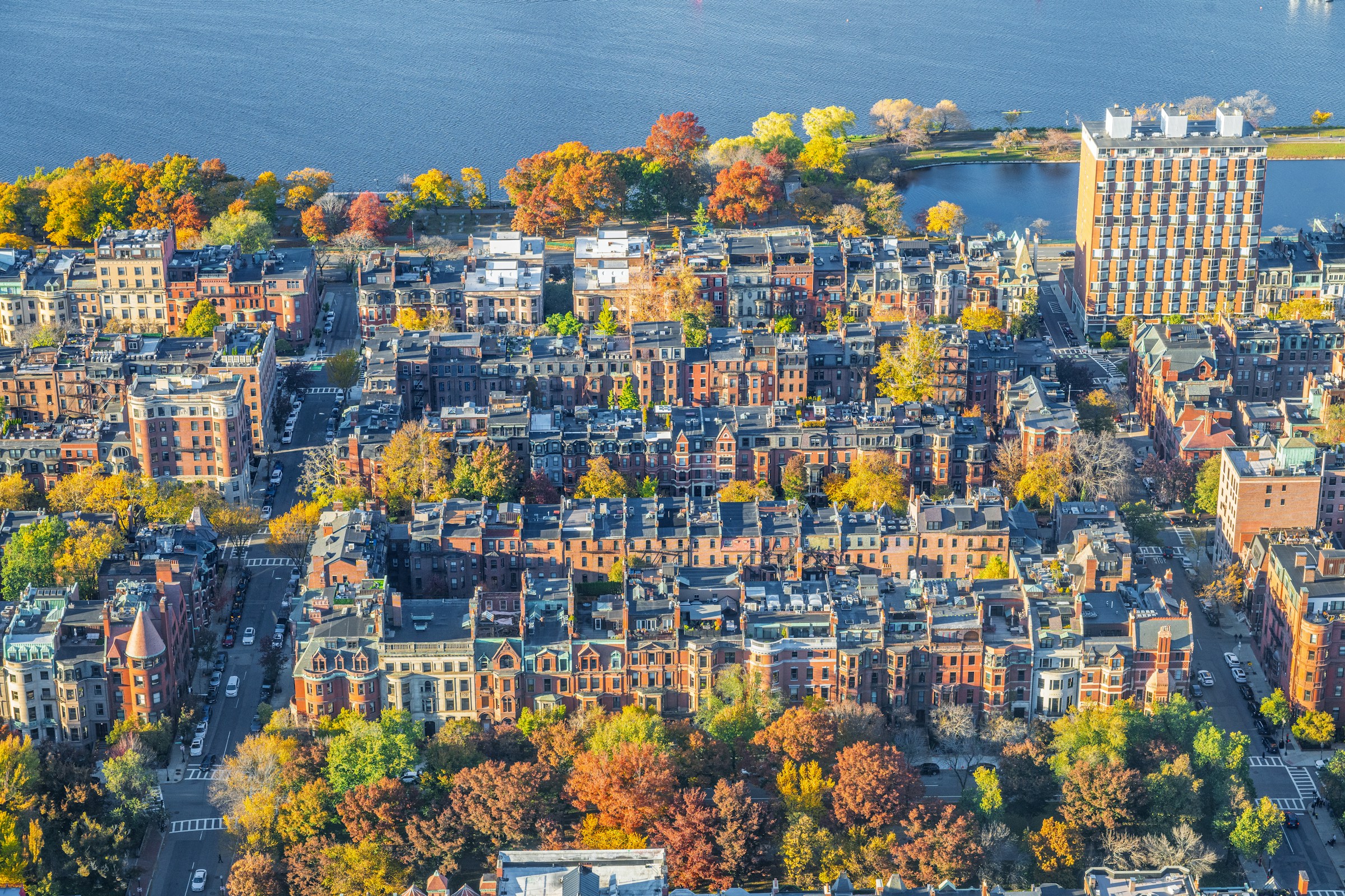
In neighborhoods such as Beacon Hill, narrow streets pass rows of brick townhouses, iron railings and small gardens. The North End combines a dense street network with Italian restaurants, bakeries and neighborhood businesses.
Across the Public Garden and into Back Bay, grand buildings and tree-lined avenues create a different, more formal urban atmosphere.
These are not isolated attractions separated by enormous distances. They form parts of a city that can be explored one neighborhood at a time.
Why Walking Changes the Experience of a City
Walkability is more than a convenience for tourists. A city that allows people to complete everyday errands on foot can change how they experience their surroundings.
Streets become places to meet neighbors, stop at a bakery, browse a bookstore or spend time in a public square rather than simply corridors for getting from one destination to another.
Walk Score gives Boston a score of 82.8 out of 100, placing it third among large U.S. cities in its national walkability ranking.
The service describes most errands in Boston as possible on foot, although accessibility varies considerably by neighborhood.
The contrast within the city is revealing. Beacon Hill and the Chinatown-Leather District area both score extremely highly for walkability, while more peripheral neighborhoods are less connected to everyday destinations.
Boston is therefore not uniformly pedestrian-friendly. Its advantage is concentrated in a network of relatively dense neighborhoods where housing, shops, restaurants, workplaces and public spaces coexist at close range.
That pattern has consequences beyond convenience. Walking can make everyday life more spontaneous, support neighborhood businesses and reduce the need for short car journeys.
It also makes a city easier to explore without planning every trip around parking. For visitors accustomed to driving almost everywhere in the United States, the experience can feel like a small but meaningful change in lifestyle.
The European Influence Hidden in the Streets
Boston’s European feel is not simply a product of its colonial past. It can also be seen in the deliberate design of some of its most recognizable neighborhoods.
Back Bay is a particularly striking example. Much of the neighborhood was created during the nineteenth century by filling tidal flats along the Charles River. Its streets and boulevards were laid out as part of an ambitious urban expansion.
Commonwealth Avenue, with its broad central green space and tree-lined walkways, was inspired in part by the grand boulevards of Paris.
The American Planning Association has highlighted Back Bay as an example of urban design influenced by nineteenth-century Paris, combining broad avenues, public green space, a connected street grid and a mixture of residential and commercial uses.
The result is a neighborhood where architecture and public space work together. Buildings frame the streets, shops open onto sidewalks, and green spaces provide places to pause between destinations.
This is an important distinction. A city does not feel European merely because it has old buildings or attractive squares. The everyday relationship between buildings, streets, public transport and pedestrian space matters just as much.
Boston’s strongest neighborhoods bring these elements together. Its first subway system, which opened in 1897, also helped establish a tradition of urban public transportation.
The Tremont Street subway was the first underground rapid-transit system in North America, built to relieve congestion on the streets above.
More than a century later, the network remains central to the city’s identity, even as its age and capacity present ongoing challenges.
Universities, Hospitals and the Economics of Livability
Boston’s appeal is not based on architecture alone. The city and its surrounding metropolitan area form one of America’s most important centers of higher education, medical research and biotechnology.
Harvard University and the Massachusetts Institute of Technology are based across the river in Cambridge, while Boston itself is home to major universities, hospitals, museums and research institutions.
This concentration creates a distinctive urban population: students, scientists, doctors, entrepreneurs and international professionals live alongside long-established communities. It also helps explain Boston’s strong performance in livability assessments.
The Economist Intelligence Unit’s index evaluates cities across five broad categories: stability, healthcare, culture and environment, education, and infrastructure.
Boston’s concentration of educational and medical institutions gives it clear strengths in several of these areas. Yet livability has a less comfortable side.
Boston is an expensive place to live, and the cost of housing can place considerable pressure on residents. Its desirable neighborhoods, major employers and universities compete for limited space.
A city can perform well on healthcare, education and infrastructure while still being difficult for ordinary households to afford.
This is why no single ranking can settle the question of where people should live. A city that offers exceptional career opportunities may not offer affordable housing.
A walkable neighborhood may come with high rents. A strong public-transit network does not guarantee that every resident has easy access to it. Boston’s success is real, but so are its trade-offs.
The City as a Collection of Neighborhoods
Perhaps Boston’s most European quality is not a particular building or street. It is the way the city can feel like a collection of smaller places.
The North End has its own culinary identity. Beacon Hill has a quieter, residential atmosphere. Back Bay combines shopping, offices, architecture and green space. The South End is known for its historic brick townhouses, restaurants and cultural life.
These neighborhoods are distinct without being entirely disconnected from one another. In the central city, walking and public transportation make it possible to move between them without treating every journey as a major logistical exercise.
Boston’s own planning agency has emphasized the importance of neighborhood centers connected by public transportation, pedestrian routes and bicycle infrastructure.
The goal is not simply to move people efficiently, but to strengthen local communities and connect residents with the services and public spaces they use every day.
That approach reflects a broader debate about the future of American cities. As housing costs rise and environmental concerns become more urgent, planners and residents are increasingly interested in neighborhoods where daily life depends less on driving.
Boston is not a perfect model. Its transit system faces reliability challenges, its streets still accommodate substantial car traffic, and its housing market remains a major obstacle for many people.
But it demonstrates what is possible when density, historic character, public transportation and neighborhood life overlap.
Not the Best City for Everyone – But a Different American Ideal
Boston’s appeal ultimately depends on what someone wants from a city. For a person seeking a large house, inexpensive living and easy access to highways, it may be a difficult choice.
For someone who values universities, cultural institutions, historic streets, public transportation and the ability to walk to everyday destinations, it offers a compelling alternative.
The city’s international reputation is therefore less important than the urban experience it provides.
Its narrow streets and brick buildings tell the story of a city that grew long before the automobile. Its boulevards reveal the influence of European planning.
Its universities and hospitals connect it to the global economy, while its neighborhood cafés, parks and local businesses keep daily life grounded at street level. Boston does not need to be declared America’s single best place to live to make its case.
In a country where so much of modern urban life has been organized around driving, its enduring appeal may lie in something simpler: the freedom to step outside, start walking and feel that the city is already within reach.
Sources and fact-checking notes
- Economist Intelligence Unit / Condé Nast Traveler – 2026 Global Liveability Index and Boston’s position among U.S. cities.
cntraveler.com - Walk Score – Boston’s walkability, transit and bicycle scores.
walkscore.com - American Planning Association – the Paris-inspired planning and urban design of Back Bay.
planning.org - American Society of Civil Engineers – history of the Boston subway, which opened in 1897.
asce.org - Boston Planning Department – neighborhood centers, transit-oriented development and pedestrian connections.
bostonplans.org - Indeed / Travel + Leisure – Boston’s separate 2026 ranking as a leading U.S. city for work.
travelandleisure.com
.